How Oxford Is Laid Out
The centre feels like a maze until you understand the logic underneath it. Once you do, the whole city snaps into focus.
The Shape of the Place
Oxford sits in a shallow bowl where two rivers meet: the Thames (called the Isis here as it passes through) and the Cherwell. The historic centre occupies a rough tongue of higher ground between them, which is why the streets curve and compress the way they do — they were never planned against a grid; they grew into the space available.
The High Street is the spine. It runs in a long, gentle curve from Magdalen Bridge in the east — where the Cherwell passes beneath — up through the commercial and academic heart of the city and out toward the west. Almost every major landmark sits within a few minutes' walk of it. Once you can orient yourself on the High, the rest opens up.
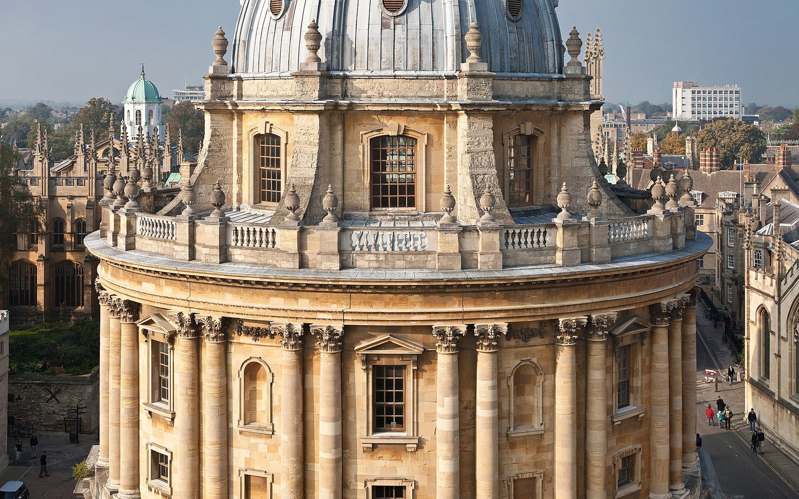
North of the High, a cluster of streets leads to the Bodleian Library, the Sheldonian Theatre, and the Radcliffe Camera — that circular domed reading room that stops most first-time visitors dead in the middle of Radcliffe Square. Beyond them, Broad Street runs roughly parallel to the High and gives you a second east-west axis to work with. These two streets, with the lanes between them, contain more of what people come to Oxford to see than anywhere else in the city.
Colleges, and Why the City Feels Closed
The disorienting thing about Oxford isn't the street plan — it's that so much of the built fabric is collegiate, and much of it is walled. Colleges are not buildings so much as enclosed compounds, each one arranged around a series of quadrangles. Walk down any street in the centre and you are passing the exterior walls of institutions that have their own internal geography entirely invisible from the pavement.
Entry is through the porters' lodge — the gatehouse office controlling access — and whether you can walk in at all depends on the time of year, the time of day, and events happening inside. Some colleges are regularly open to visitors; others rarely are. The result is that the streetscape you see from outside gives almost no indication of what lies behind it, and newcomers keep trying to navigate a city where significant portions of the map are periodically unavailable.
The practical fix is simple: stop trying to see the inside of every college and choose one or two. Walk through them attentively. The quadrangle is the basic unit — a closed court of buildings — and once you know how to read one, you've essentially understood the grammar of all of them.
Colleges are not buildings so much as enclosed compounds, each one arranged around a series of quadrangles.
The Edges
The centre fades at the edges into places that feel immediately more breathable. To the south, Christ Church Meadow opens behind the college walls and gives you the river, the old city silhouette, and a broad pastoral circuit that is free and always accessible. To the west, Jericho — Oxford's Victorian working neighbourhood, built to house canal workers and printshop employees — sits ten minutes from Carfax and has no queues, no entry fees, and most of Oxford's better neighbourhood restaurants. To the east, Magdalen College backs onto its own deer park, and the Cherwell curves north toward University Parks and the quiet stretches used by punts in the warmer months.
The city is genuinely small. The distance from Magdalen Bridge to the western edge of Jericho is barely a mile and a half. The apparent complexity of the centre comes from the collegiate walls and the absence of a grid, not from real size. Most first-time visitors spend too long in the immediate orbit of the obvious landmarks. Walk five minutes in almost any direction, and the crowd — and the sense of being in a maze — largely disappears.
Related